Original words, shots by Charles Montgomery and Carla Mancuso. Updated by 10 magazine editorial team, April 2026, with field notes from a recent editorial walk visit.
Scenic beaches, volcanic cliffs, waterfalls hidden in forest, horses roaming green hillsides, and citrus groves rolling toward the sea — these are just some of the sights that walkers encounter on Jeju’s Olle Trail (올레길). A priceless opportunity for anyone from a casual day-hiker to a long-distance trekker, the trail offers an unhurried and often spectacular way to experience Jeju at a human pace.
About the Jeju Olle Trail
“Olle” (올레) is a Jeju dialect word for the slender alleyways that wind from the street to the front gates of homes, paths that connect people to the world outside. The idea of turning that word into a walking trail came from Suh Myungsook, a former magazine editor who, after completing the 800 km Camino de Santiago in Spain, decided to build something similar on Jeju.
With a team of volunteers, Suh set about finding forgotten roads, restoring overgrown paths, and mapping a route around the island’s entire perimeter. The first course opened in September 2007, and the trail has grown steadily since, today covering 437 km across 27 routes (21 main courses and six sub-routes).
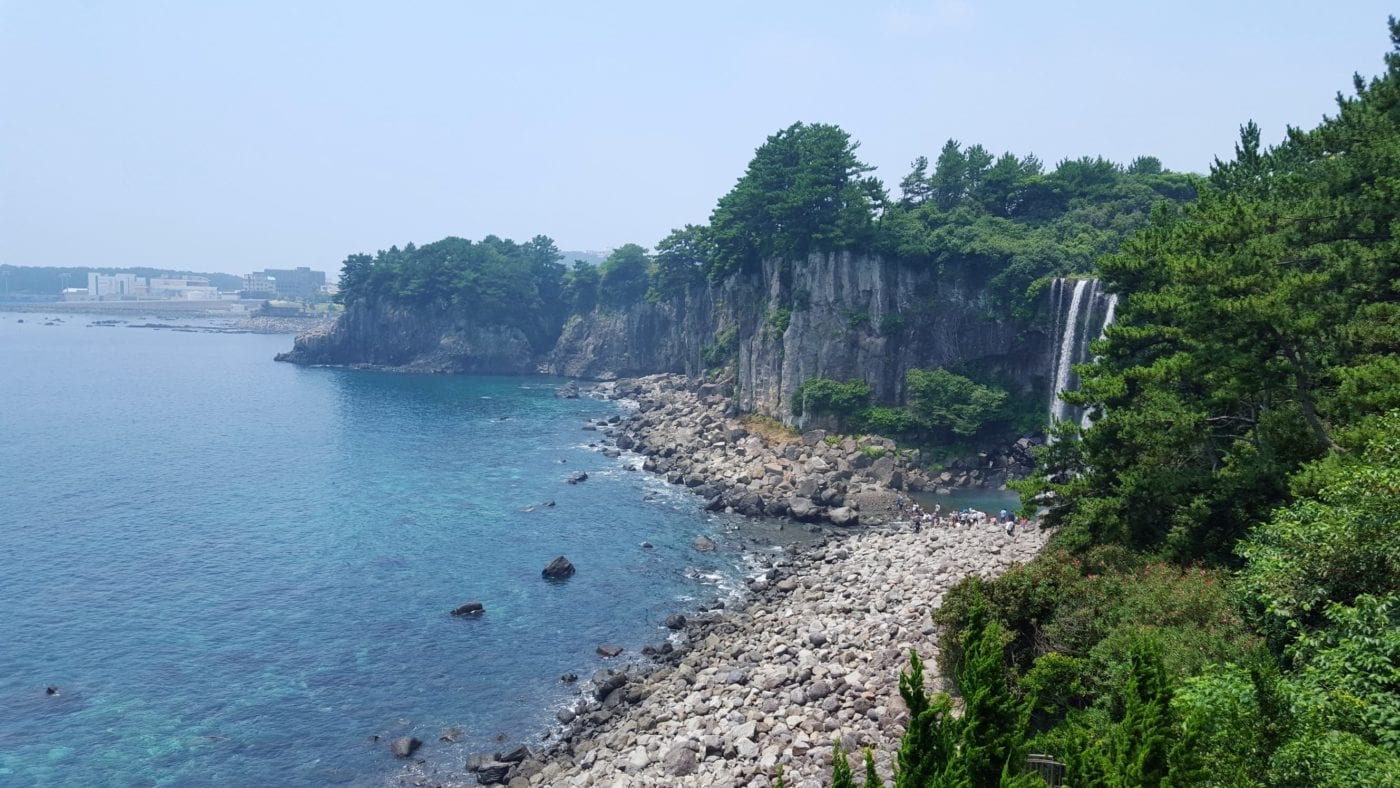
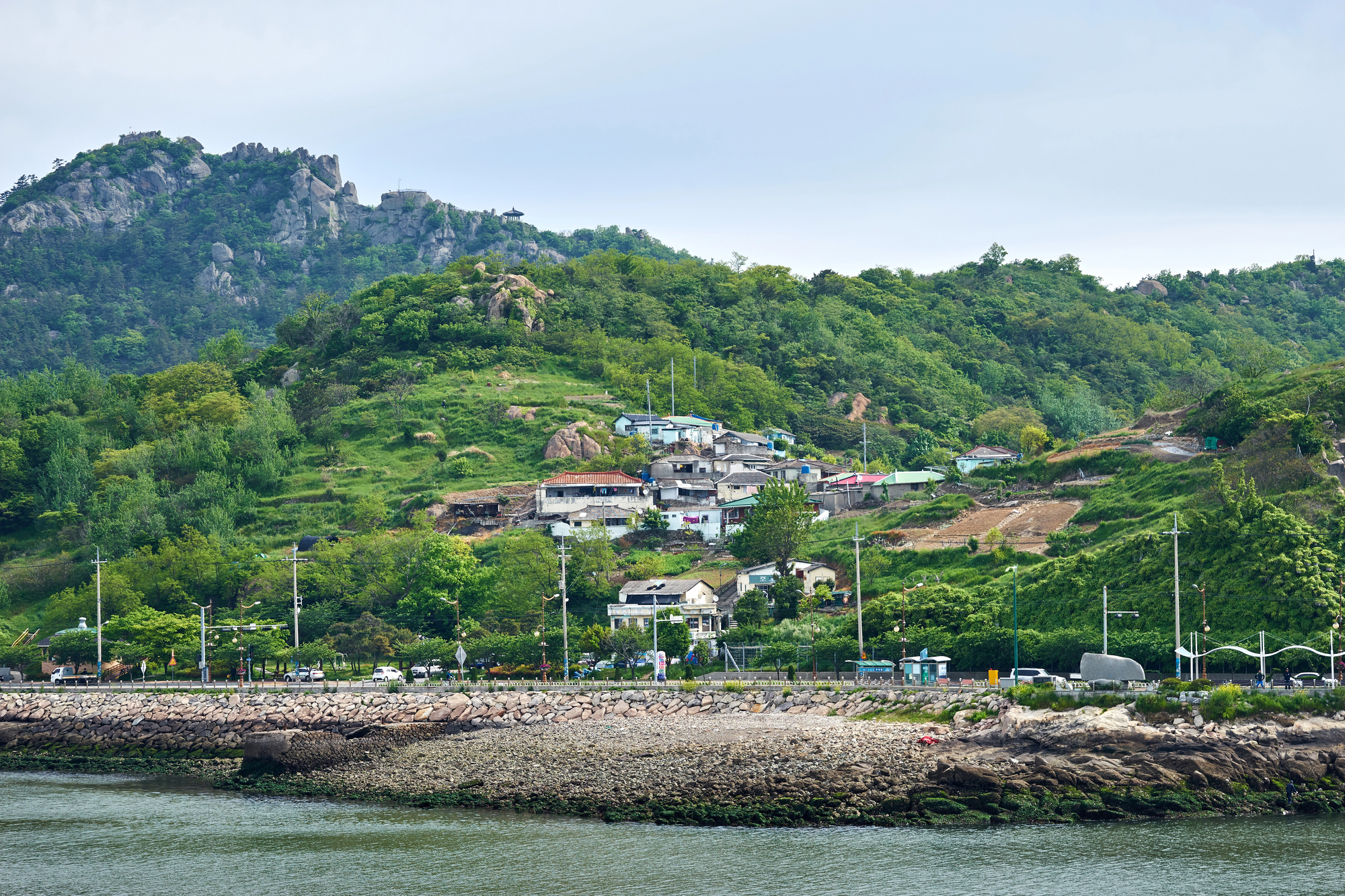
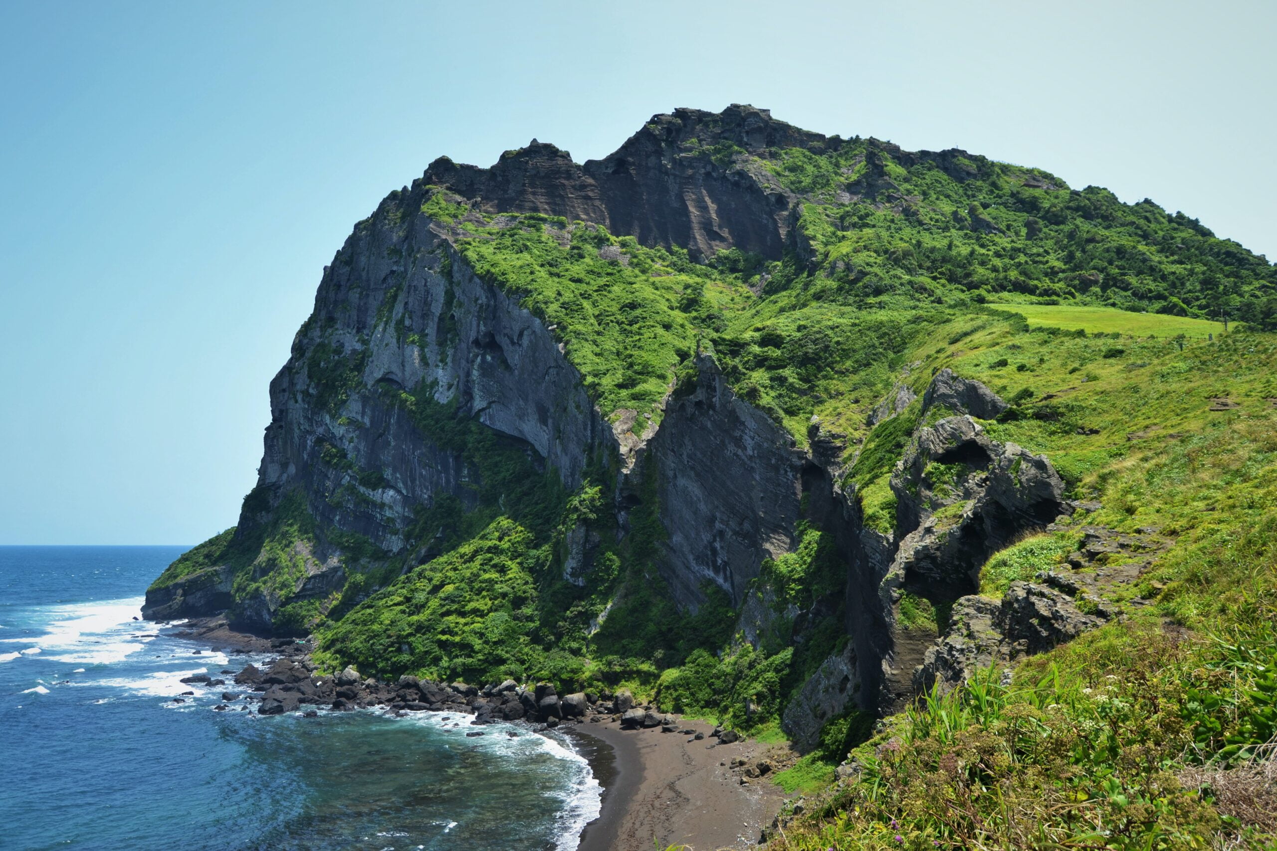
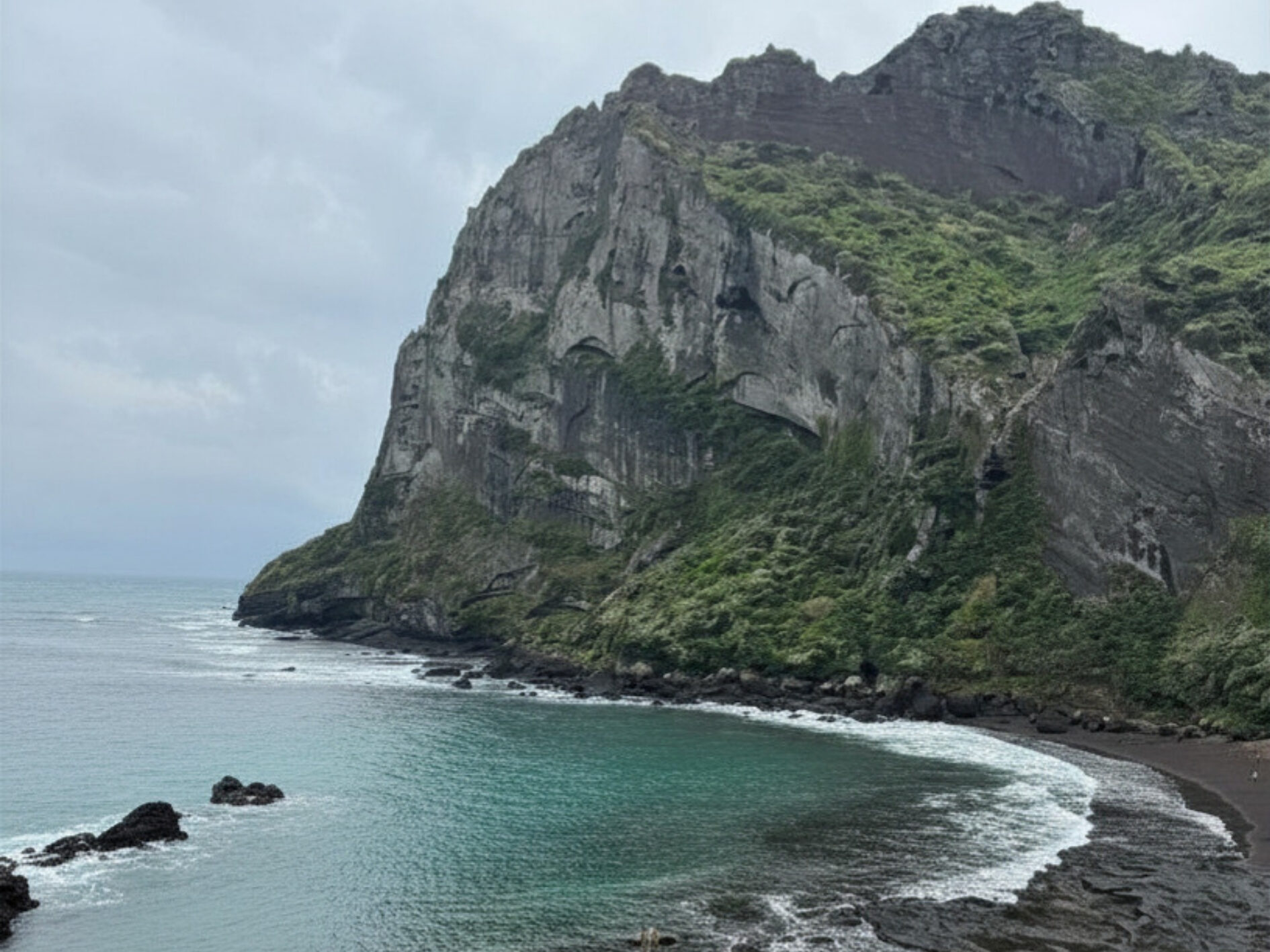
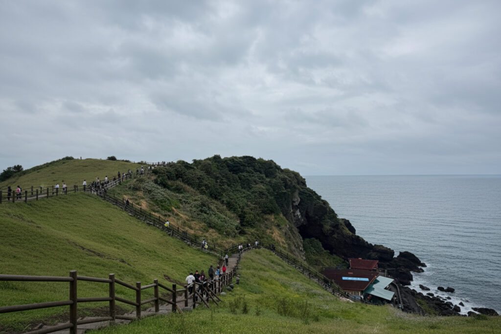
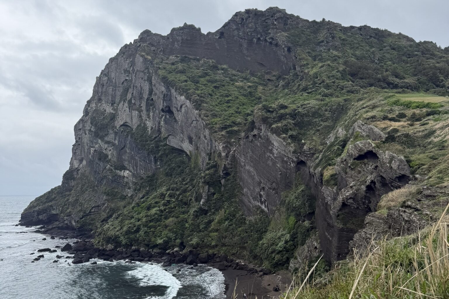
The courses are wonderfully varied. A single day’s walk can carry walkers through fishing villages, past kilometres of the stone-walled fields that are so characteristic of Jeju, and suddenly out to the coast — where Jeju’s famous haenyo (해녀, female divers, most now elderly) can sometimes be spotted emerging from the sea in their black wetsuits. For a closer look at one of the most dramatic viewpoints on the southern coast, read our Jeju Discovery feature on Oedolgae Rock. Some sections tunnel through dense vegetation, others follow city streets or even short stretches of highway. The trail is clearly marked throughout with blue and orange ribbons, painted arrows, and small blue horse statues made from pipe — the horse being Jeju’s most beloved symbol.
On the Trail: What to Expect
Bathrooms are available at the start and end of every course, and at well-marked points in between. Restaurants and cafés appear frequently in town sections, though more rural stretches can be sparse, carrying snacks and at least a liter or two of water is always a good idea.
From the Trail — April 2026
“Spring sections along the coast are gorgeous, but the wind picks up fast on exposed clifftops, pack a light windbreaker even on sunny days. Shade is limited on seaside stretches, so sunscreen and a hat are worth bringing too.”
One of the wonderful surprises of the trail is the warmth of Jeju’s residents. Wherever walkers stop, people want to talk; hotel owners go out of their way to help find next-night lodging; and getting lost often leads to an impromptu local escort. Outside the main cities of Jeju-si (north) and Seogwipo (south), however, English is rarely spoken, a translation app and a few Korean phrases go a long way.
The official time estimates for each course should be taken with a grain of salt. Most walkers take roughly 1.3 to 1.5 times the listed duration, particularly when carrying backpacks or stopping frequently.
“Course 7 is listed at around 4–6 hours. With regular photo stops and a proper sit-down lunch by the sea, plan for the full 6–7 hours. The pace is part of the joy.” – Carla, part of 10 Magazine Team
The Olle Passport
On the first day of any walk, make sure to pick up a Jeju Olle Passport (20,000 KRW) from one of the 14 trail information centers across the island — including the dedicated Jeju Olle desk opposite domestic arrivals at Jeju Airport. At various points along each course, stamps can be collected in the passport, and completing all routes earns a verification certificate and commemorative medal.
When to Go
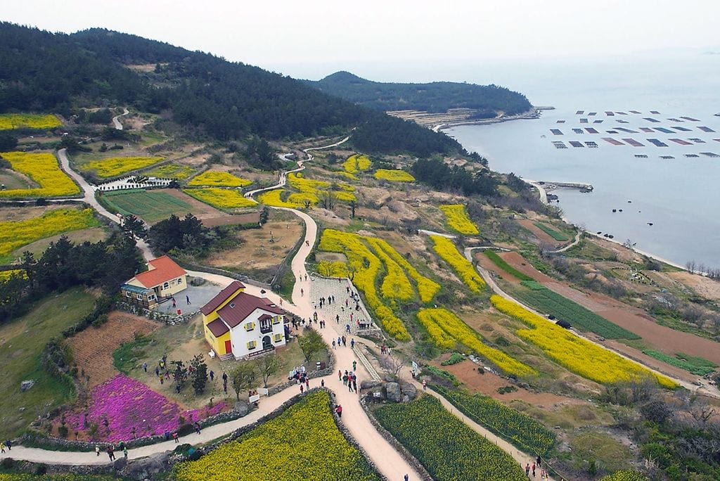
Spring (late March to mid-May) is one of the best times to walk, canola fields bloom bright yellow, cherry blossoms line forested stretches, and temperatures are comfortable before the summer humidity sets in. Autumn (mid-September to mid-November) is considered the single best season: cooler air, quieter paths, and vivid foliage. For short trips, it is worth checking the forecast and planning Jeju Olle Trail days on clear, sunny weekdays when possible, as views and footing are much better in dry conditions. If you want to mix hiking with time on the fairway, our guide to the best courses for golf in Jeju Island highlights the island’s top golf spots
During the peak summer season — roughly July 15 to August 27 — and around major Korean holidays, accommodation near Jeju-si and Seogwipo fills up fast. In the off-season, pensions, yeogwan (여관, budget motels), and minbak (민박, private guesthouses) are plentiful and affordable along almost every route.
You can find more information about each of the trails (maps , duration, etc.) on the official website here (all in English).
Getting There
Flights leave from Gimpo Airport (Seoul) to Jeju International Airport throughout the day. From the airport, Bus 100 connects to Jeju-si Intercity Bus Terminal, from which all island locations are accessible. Intercity bus announcements for Olle Trail courses are made in English, making the stops easy to find. Download KakaoMap or Naver Map for real-time navigation, and keep Kakao T handy for taxis from more remote route endpoints.
Full route maps, distances, and English-language guidance are available at the official Jeju Olle Trail website.
| Charles Montgomery writes about translated Korean literature at his website, ktlit.com.
While you’re in Jeju, make sure to find and try these unique specialty foods ! And comment down below if you find this article helpful.
If you’d rather relax than walk or hike, we suggest these 10 Jeju Beaches to soak up the sun.