|Words by Malcolm Wrest|
South Korea has a vast amount of natural beauty telescoped into an endearingly petite compass. However, that beauty will remain largely undiscovered if you do not trouble yourself to venture out beyond the urban settings in which so many of us are employed. As many are already aware, Korea boasts numerous hiking trails that have been favored haunts for the perambulatory adventurous for many a decade now!
Less well known, though, is that Korea also now boasts genuinely outstanding cycling trails that have been heavily invested in with the passage of the national government’s “Four Rivers Project” developing the infrastructure of the titular rivers Han, Nakdong, Geum, and Yeongsan. The granddaddy trail of them all—and the backbone of several subsidiary trails—is the trans-national route running from the west coast of Incheon across through immediately neighboring Seoul and then down, down, down to the thriving metropolis of Busan in the far southeastern corner of the country, many hundreds of kilometers away.
This trail is for the most part a world-class route, following first the Han, briefly crossing over the mountainous spine of ranges running through the country, and then tracing the course of the Nakdong River along clearly marked dedicated paths. The trip will require a reasonably fit individual for just six to seven days to complete.
What to See
“K-Water” (official website), the governing agency over the country’s rivers and the paths therein, has invested a large amount of effort into the aesthetic design of the various weirs that now cross the nation’s rivers and which interact with the cycle paths themselves. The result is that many of them are now literally architectural works of art. These simply exquisite engineering works are a delight to behold and really set a standard for other world utilities to follow!

The Four Rivers trails also pass by countless historical sites, wildlife preserves, famous restaurants, and natural landmarks. A full guide to sightseeing on a bicycle is available at Riverguide in Korean and English.
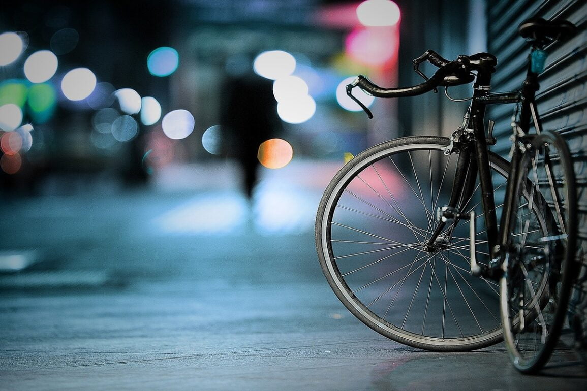
The tranquil rural scenery of one splendid vista after another—which on a bicycle you become part of, rather than being a mere observer from within the confines of a vehicle—will form a large part of the memories of anyone that commits to completing this route. As a philosopher has noted, the journey ultimately becomes you! On several occasions I found myself thinking how beautiful Korea was as I passed by a brood of swans at the bank’s edge or the reflection of cliff faces jutting out abruptly into the water.
Challenges
What might be the greatest obstacle to anyone cycling this route? Perhaps not having trained hard enough in the switchbacks traversing the French Alps during the off-season of the professional circuit? Or not being in possession of the latest aerodynamically fluted composite carbon fiber titanium alloy professional racing cycle?
I would suggest not!
The biggest obstacle is actually being able to string together the time necessary to complete this route. While a few dedicated cyclists can manage Seoul to Busan over little more than a weekend (see korea-randonneurs.blogspot.kr), it’s an incredibly difficult task. It’s also a journey on the road rather than the scenic paths of the rivers, and riding through both day and night—an endeavor would severely tax the majority of recreational cyclists. So we suggest taking a long way instead.
- Speed
At 633 km in length, averaging a distance of 100 km a day, the trip would require six days. Five solid hours on the bike at a not-unreasonable 20 km/hr will give you 100 km a day and leave time for meal breaks and stops, though you are likely then to need an eight to nine-hour stint in total produced consecutively over many days.
How difficult is the route? I felt tired at the end of the first day and STILL felt tired from the previous day’s efforts on the second, third, and subsequent days. But the muscles “hardened up” quickly enough that the pain barrier became more just overcoming general fatigue than struggling with any excruciating agony.
- Accommodations
There is little information along the route itself in relation to accommodation for the night or regarding places to stop and eat. Without preparation, every night was utter “guesswork”, just pulling out the mobile late in the evening to look for an accommodation symbol on the electronic maps that indicated the location of the nearest motel of some nature. Not really what one wants to be doing at the end of a hard day’s ride!
To prepare a little better, take a gander at www.riverguide.go.kr. The site hosts information on both camping grounds and Biketels, which are accommodations along all Four Rivers routes where you can store your bike and rest. These motels, minbak, yeogwan, and even Hanok villages are guaranteed to have bike storage space for travelers on two wheels. Phone numbers for Biketel reservations are available on the Biketel map, while reservations for camping facilities can be made directly on the site. And while the route guides are available in English, all accommodation info is in Korean—so ask a friend for help if your language skills aren’t ready for the challenge.
RiverGuide also has an extensive menu of “Gangbyun Matjip” or riverside foodie finds. The selection is organized by location and food type. Plan your eating in advance to make sure you taste the best of each region you pass through.
- Terrain
The trail is still a “work in progress” in sections. The route immediately into Daegu and immediately out were nightmares to navigate, being poorly signed and with little provision for cyclists (e.g. poor signage and little to keep cars and bikes out of each others’ way).
Part of the route just a little further south of Daegu is on gravel trails through hills, with some ensuant grade to ascend that may be more suitable perhaps for mountain bike enthusiasts. I personally detoured around this section by following Route 5, which approximately parallels the river for some 40 km from Bakseokjin Bridge (夢戮霞掖) down to the road’s intersection with Route 1022, Nakdong Way (釩翕煎), almost immediately on the north bank of the river.
There also is a long, steady grade along the final five kilometers climbing up to the Ihwaryeong Rest Area (檜‘“) which represents the halfway point separating the respective catchments of the Han and the Nakdong. However, there are otherwise relatively few points of climb in the course of the journey.
Recommendations
- Carefully study the weather reports in advance of your journey, in particular wind strength and wind direction.
- Elect to have some company if possible (but if not possible, go anyway!). I considered discontinuing twice in the journey. To do so is merely a matter of putting the bike on an intercity bus at any of the terminals in the larger towns that you pass through and then heading right on back home. But having the encouragement of another rider or two sharing your travail might make for the perception of a shorter journey.
- Avoid riding for too long at night. Late afternoon, sunset and perhaps 30 minutes into the evening were one of my favorite times to ride. That said, the chances of losing your way on near identical-looking side trails or simply having a minor accident greatly increases.
- Don’t fill the panniers on your bicycle! You may have the capacity to take the proverbial kitchen sink, but you’ll quickly regret its weight.
- Bring a spare tube, pump, levers and tools by all means—but also invest in a pair of quality tires (e.g. Schwalbe Marathon) from the very beginning. While I came prepared for a mishap, I rode the entire course without a single flat tire!
- While it is really not beyond the ability of anyone to ride this route, some limited preparation would definitely help. For example, knowing what 100 kilometers “feels like” beforehand provides some valuable self-confidence and the all important battle: hardened buttocks and thighs! Fortunately, English-speaking organizations such as the Han River Riders provide many opportunities to ride in advance with keen and knowledgeable cyclists along a variety of routes in and around Seoul. (see either www.han-river-riders.com or Han River Riders on Facebook.)
- If you choose not to make any preparation at all, the ride may still prove possible, but as the kilometers pass you will likely find yourself unpleasantly discovering muscles you never even realized you had. It helps to invest in a reasonably good bicycle with a quality seat.
- If possible, allocate more than the bare number of days necessary to complete the route. A major regret of mine is that there was simply not enough time to be able to stop and linger over the highlights of the journey like Sangju’s Bicycle Musuem and the Upo Wetlands. On several occasions, I would have liked to have had a day or two to spare to explore all the intriguing little corners that I instead just rode by. But owing to the overriding obligation to be back at work first thing the next Monday, I could not afford to stop.
- Purchase one of the “Four River Passports” that includes a map and destination guides. If you do, you’ll be able to stamp this guide along the way and earn an official certification of your journey at the end. Purchase and stamping locations are detailed in English and Korean on www.riverguide.go.kr.
- Stop for a breather. Make yourself slow down and look for the beauty around you when the effort starts to become too arduous. There is no need to race to the finish line in this event.
If you are interested in vacation ideas for the summer, check out our article “5 Relaxed Summer Getaways“.
|Malcolm Wrest has just finished his twelfth and final year in Korea. An instructor in Incheon University, he is thankful for the many wonderful memories in Korea that he will soon be looking back on.|